
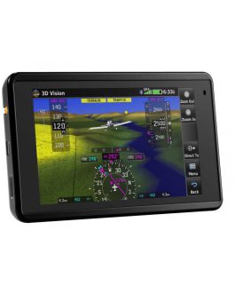
aera 796
3-D Navigation with MFD and EFB Capability
- Rugged and robust, purpose-built aviation design with built-in GPS and 7-inch sunlight-readable touchscreen
- 3D Vision perspective view displays terrain, obstacles, airports, traffic and more
- Cockpit connectivity via Connext using compatible devices¹
- Class I/II EFB electronic flight bag provides access to global georeferenced charting options, document viewer and more
- Easily access street intersections for quick navigation
195,500.00KShs
Description
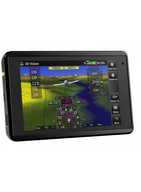
Explore Revolutionary 3D Vision Technology

Experience a groundbreaking technology with aera 796’s 3D Vision feature, providing a virtual 3D perspective of the terrain surrounding your aircraft. This cutting-edge feature, previously exclusive to panel-mount avionics, offers a unique view of land and water features, obstacles, runways, and airport signposts in relation to your aircraft’s position. Simply swipe your finger across the touchscreen to rotate the view and gain a deeper understanding of your surroundings.
Enhanced Terrain Awareness
aera 796 goes a step further with its forward-looking terrain avoidance capability. It predicts potential tower or obstacle locations and highlights them with amber or red overlays, ensuring you’re aware of potential hazards. The device’s internal GPS updates your position a remarkable 5 times per second (5 Hz), providing you with continuous and smooth access to 3D Vision and other crucial flight data.
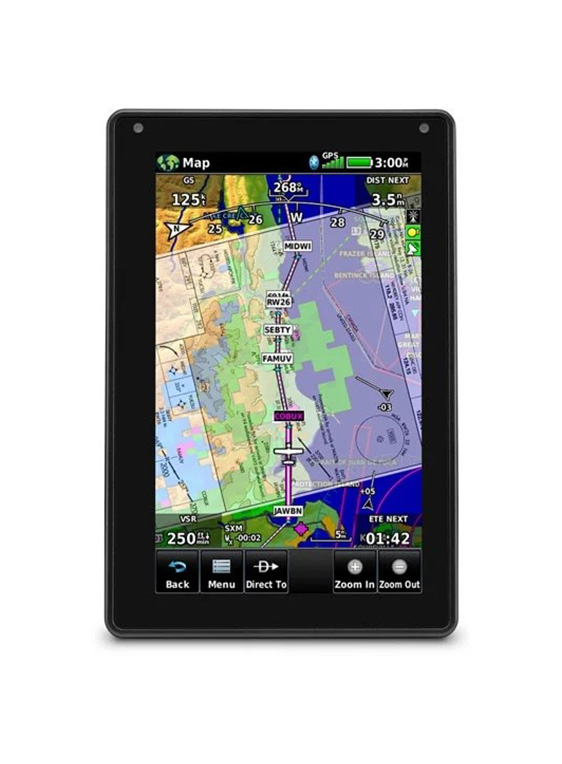
High-Definition Display
The aera 796 boasts a brilliant 7-inch diagonal high-definition sunlight-readable display, ensuring optimal visibility in all lighting conditions. It’s adaptable to both portrait and landscape modes, and its design is optimized for yoke or knee-mounted use. The bezel features just four touch keys for quick access to frequently used functions, while other functions are easily accessible through intuitive onscreen icons with labels. The touchscreen interface also allows for effortless panning and pinch-to-zoom navigation.
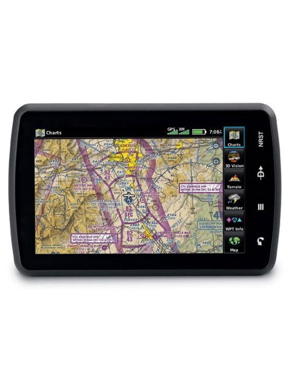
Embrace a Paperless Cockpit
aera 796 serves as an electronic flight bag, reducing reliance on paper charts in the cockpit. Preloaded U.S. georeferenced VFR sectional and IFR enroute charts overlay your aircraft’s position directly on the relevant chart. Optional European and Canadian VFR and IFR charts are also available. In IFR map mode, the device displays victor airways, jet routes, minimum enroute altitudes, and leg distances akin to traditional enroute charts. Georeferenced Garmin Flite Charts provide approach charts and airport diagrams for the U.S., Canada, and Europe. Pilots who prefer Jeppesen charts can utilize the optional Garmin Chart View service, offering global georeferenced charting capabilities.
Versatile Document Viewer
aera 796 features a robust document viewer, enabling you to access weight and balance information, flight manuals, raster charts, and various electronically formatted materials. The “scratch pad” feature lets you quickly jot down clearances and notes in-flight, while the checklist viewer allows for the creation of customized and interactive electronic checklists.
Elevate Situational Awareness
The device incorporates a built-in terrain database and U.S. and Canadian obstacles database, providing a 3D view in 3D Vision mode and a top-down view of your entire route. SafeTaxi offers detailed taxiway diagrams and position data for many U.S., European, or Canadian airports. Additionally, a private airport and heliport database expands your emergency “nearest” options. For facility information at most U.S. airports, consult the preloaded AOPA Airport Directory Data, or opt for global AC-U-KWIK airport directory data for international flying.

Weather and Radio Access
With the optional GXM 42 antenna, aera 796 grants access to high-resolution weather and in-cockpit audio entertainment (subscription required). Alternatively, the optional GDL 39 series datalink provides access to ADS-B weather and traffic data, overlaying it onto your navigation and topographic maps.

Expand Your Connectivity
aera 796 offers dual serial ports, allowing simultaneous connectivity with other hardware. Add the optional GTX 330 Mode S Transponder Interface for Traffic Information Service (TIS) alerts on the device, along with frequency control for a GTR 225 Communication radio or GNC 255 Navigation/Communication. The device can even relay position reports to other devices for comprehensive communication.
For added convenience, consider incorporating City Navigator maps, which enable both helicopter and fixed-wing pilots to use street addresses as waypoints or direct-to destinations. The device features an SD™ card slot for easy updates and expansions, allowing you to manage and purchase the latest aviation data through fly Garmin.
Only logged in customers who have purchased this product may leave a review.
Reviews
There are no reviews yet.